Blog Posts

6.29.26
Ninety-five percent Roadway Coverage in Just 96 Hours—Without Messing Up Daily Operations
Municipalities are under serious pressure as they try to keep aging roads safe while dealing with tight budgets, staff shortages, and higher expectations from the public. The old way of doing things—sending out dedicated inspection crews for periodic surveys—requires a lot of planning, time, money, and it only provides a snapshot of what is really going on.
There is a smarter approach: route-based scanning.
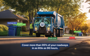
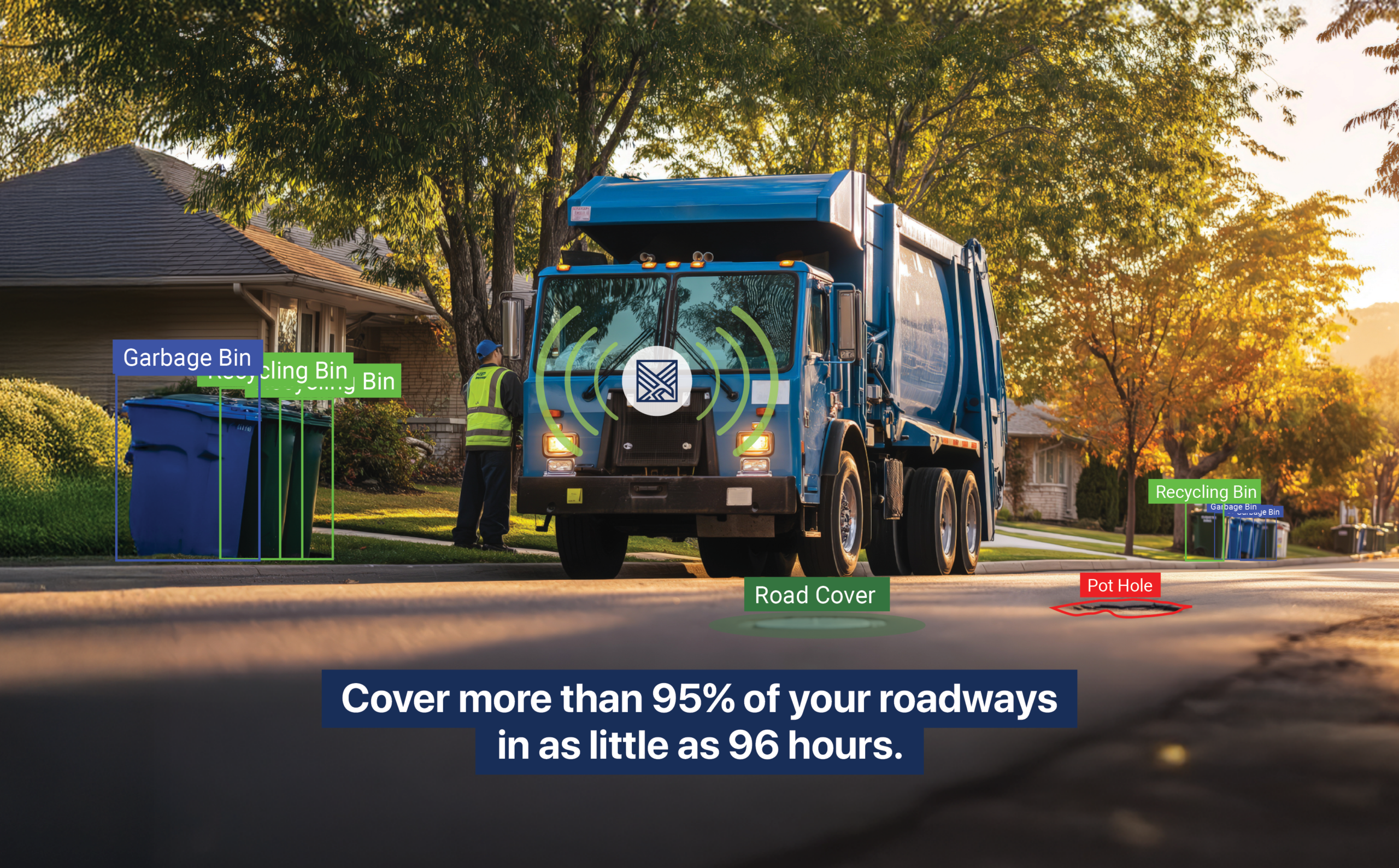
Mitsubishi Electric Automotive America has developed a solution, called Urban Hawk™, that turns city or county vehicles, which are already being driven around every day, into powerful infrastructure monitoring systems. By adding cameras and smart AI to existing fleet vehicles, towns, cities and counties can cover more than 95% of their roadways in as little as 96 hours—without hiring extra people, closing roads, or interrupting normal operations.
Instead of sending out special inspection trucks, Urban Hawk uses the vehicles that are already being used for everyday jobs: garbage trucks, public works vehicles, street sweepers, and so on. As they follow their usual routes, vehicles equipped with Urban Hawk technology quietly capture images of the roads. AI then analyzes the images and flags issues such as crumbling pavement, big potholes, damaged or missing signs, guardrail problems, and other hazards.
This changes everything about how municipalities monitor their infrastructure. Rather than getting occasional check-ups, they receive a constant stream of fresh data from vehicles that are already driving every street in town, building a comprehensive, up-to-date picture of road conditions with almost zero extra effort.
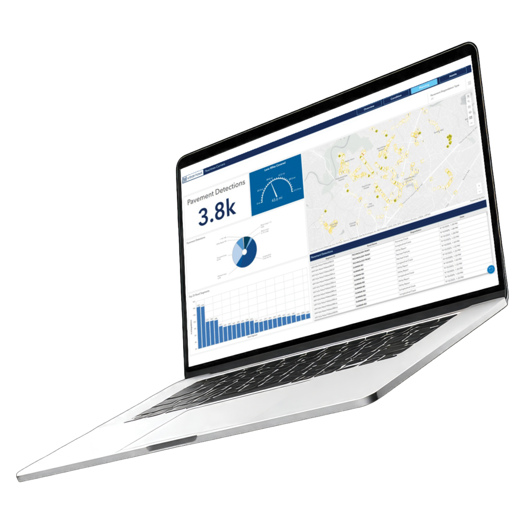
But it doesn’t stop with just collecting data. Urban Hawk turns those images into useful intelligence. The technology automatically spots problems, maps them in GIS, and can even help generate work orders. That means crews can respond faster to serious issues—like a dangerous pothole or a missing stop sign—before they cause accidents.
The big shift is evolving from reactive maintenance (waiting until something breaks) to proactive asset management. With clear real-time visibility into the actual condition of the roads, cities can fix the most important things first, stretch their budgets further, and prevent small problems from turning into expensive ones. It also produces standardized reports, including PASER (Pavement Surface Evaluation and Rating), that make planning and budgeting much more objective and defensible.
And here’s the best part: it barely disrupts anything. You don’t need special crews. You don’t need road closures. Cameras can be installed across an entire fleet in less than a day. Your teams keep doing their normal jobs while the system collects valuable data.
As cities look for practical, cost-effective ways to maintain their infrastructure, route-based scanning stands out as a genuinely scalable solution.
What used to require extensive time, labor, and disruption can now happen as part of everyday operations. The result: Faster identification of problems; smarter maintenance planning; and a much more proactive approach to taking care of public assets.

Subscribe for the Latest
Subscribe for the Latest
Recent Blog Posts