Blog Posts

7.27.26
Why Cohesive Infrastructure Data Is the Missing Link in Capital Planning
Cities have never had more infrastructure data at their disposal. Yet many still struggle to make informed capital planning decisions because the information they rely on is fragmented across multiple systems.
Road condition assessments, Geographic Information System (GIS) mapping, maintenance records and inspection reports often exist in separate databases that don’t communicate with one another. By the time that information is compiled, it’s frequently outdated, leaving public works departments making multimillion-dollar maintenance and investment decisions with an incomplete picture of asset conditions. This can lead to higher long-term costs, emergency repairs and increased safety risks for motorists.
That challenge comes at a time when local governments are being asked to do more with less. Aging infrastructure, tighter budgets and rising public expectations are forcing many agencies to prioritize projects with greater precision than ever before. Relying on periodic inspections or resident complaints is no longer enough.
Capital planning requires continuous, accurate data that helps agencies understand not only where assets stand today, but where they’re headed tomorrow.
Most municipalities already collect large amounts of infrastructure data. Pavement ratings are tracked through Pavement Surface Evaluation and Rating (PASER). Asset locations are managed through GIS. Maintenance activities reside in work order systems. Traffic control devices must comply with the Manual on Uniform Traffic Control Devices (MUTCD).
When data remains isolated in separate systems, agencies have difficulty identifying trends, predicting asset deterioration and prioritizing investments. Roads that appear acceptable during scheduled inspections may deteriorate rapidly before the next assessment. Missing or damaged traffic signs may go unnoticed until someone reports them. Small pavement defects become expensive emergency repairs.
Without a single, current view of infrastructure conditions, capital planning becomes reactive instead of strategic.
Advances in artificial intelligence and digital twin technology are helping municipalities close that gap.
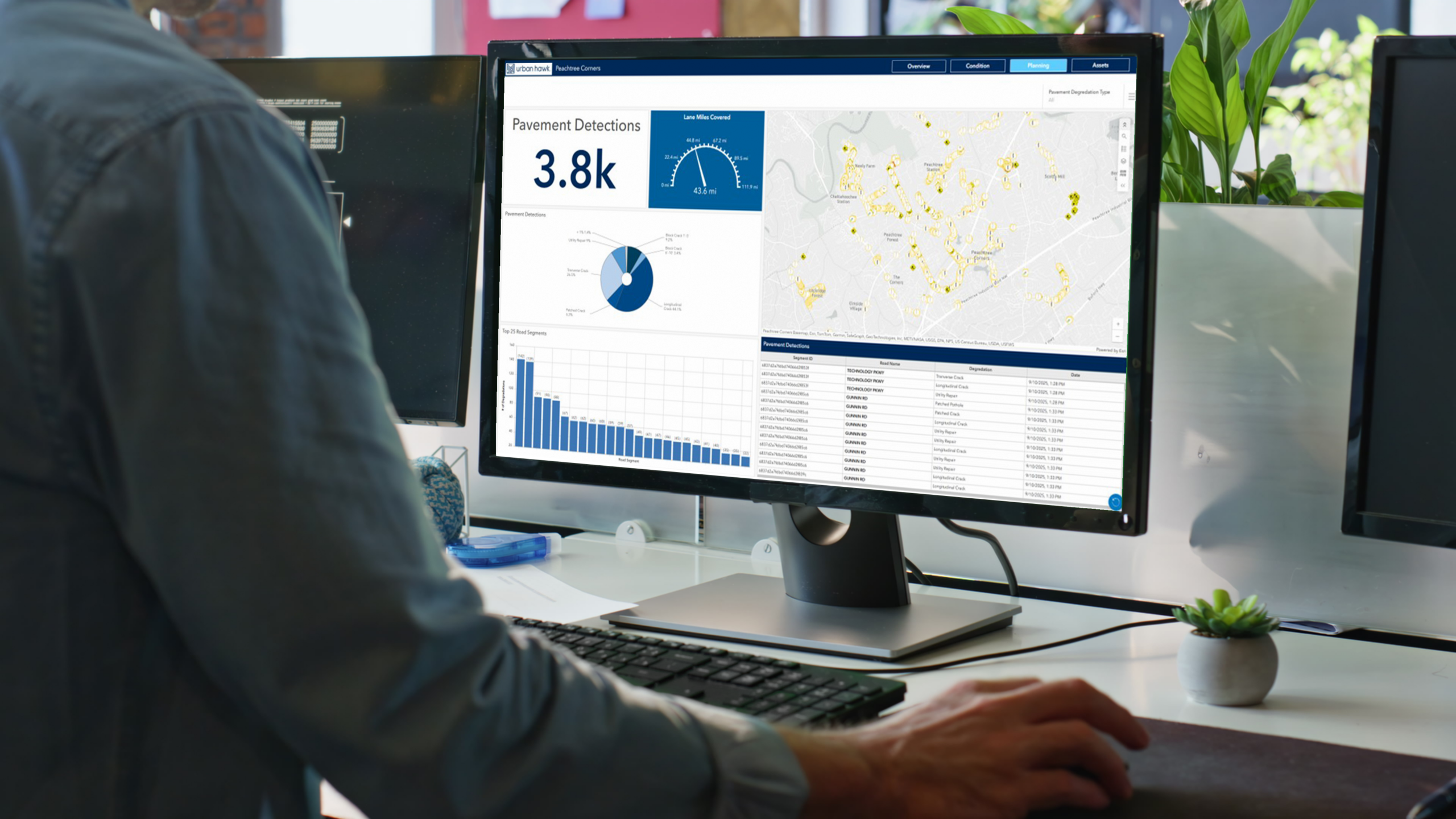
Mitsubishi Electric Automotive America Inc.’s Urban Hawk™ platform continuously monitors roadway infrastructure using AI-powered image analysis and GIS-based digital twins to provide near real-time visibility into asset conditions.
The platform continuously evaluates infrastructure and identifies changes as they occur, detecting pavement deterioration, damaged guardrails, missing or obstructed traffic signs and other roadway issues while supporting PASER-compliant pavement assessments. This is a significant improvement from relying solely on scheduled inspections.
Just as important, Urban Hawk consolidates that information into a single platform that integrates with existing municipal systems. Agencies can automatically generate work orders, maintain historical imagery for liability documentation and analyze trends that support long-term capital planning. Instead of reviewing isolated data points, decision-makers gain a comprehensive view of infrastructure health across their entire roadway network.
Access to cohesive infrastructure data changes how agencies allocate limited resources.
Rather than responding to the loudest complaints or relying on outdated inspection cycles, municipalities can prioritize projects based on actual asset conditions and predicted deterioration. Maintenance can be scheduled before problems become costly failures, extending the life of existing infrastructure while reducing emergency repair costs.
The same data also strengthens public safety by identifying hazards sooner and helping agencies document compliance with infrastructure standards.
For communities facing growing infrastructure needs and limited funding, that shift from reactive maintenance to proactive planning can have a significant impact on both budgets and roadway conditions.
As cities continue investing in smarter transportation systems, the quality of capital planning will increasingly depend on the quality of the data behind it. Collecting more information isn’t the goal. Connecting existing information into a single, actionable view is.
Platforms such as Urban Hawk demonstrate how artificial intelligence, digital twins and integrated asset management can give municipalities the insight needed to make more informed investment decisions, improve roadway safety and maximize every infrastructure dollar.
For agencies planning the next generation of infrastructure improvements, cohesive data is no longer a competitive advantage – it’s a prerequisite for effective capital planning.


Subscribe for the Latest
Subscribe for the Latest
Recent Blog Posts